It's a beautiful morning in Kyburz, CA as I look out my motel room window at this scene:
We're about 30 km southwest of Lake Tahoe after spending the past three days covering a lot of ground since we left Prescott Valley Wednesday morning. Let me go back to the beginning and you'll see what marvels we've seen in our latest travels. First, Emily returned from Alaska Tuesday evening so we caught up with her for an hour and then took off first thing the next morning. Our time there was great and Penny and I decided Radar, who is an English Shepherd, would make a wonderful dog for us, whenever we decide we want a dog again.
When we left we had a rather ambitious plan as we didn't have to be in San Francisco until Saturday. Our first day had us driving north through Flagstaff to grab breakfast (stopping to see a replica of the original "flag staff" of course):
From there we headed north to Page, AZ to see Horseshoe Bend, the Glen Canyon Dam/Lake Powell and tour Antelope Canyon. I'm going to editorialize a bit here first. Horseshoe Bend is on Navajo land so they own the concession rights. We encountered the same deal when we stopped at the Four Corners Monument. I was at Four Corners in 1977 and it was just a cairn that marked where the four states met... nothing special. When we went earlier on the trip it's now an "attraction" for which the Navajos charge admission and have set up a market selling native trinkets, swarming with tourists.
Horseshoe Bend is the same, but worse. It's marketed as a stunning sight, red cliffs, blue water, etc. When you arrive and pay your admission fee there's a huge sign displaying the same image. I'm sure, if you see it at just the right time of year and just the right time of day, it might look like that. However, in my experience, the Colorado river is usually muddy and green and that's what we saw... along with a billion tourists taking selfies in front of it.
Meh. Truth in advertising. Not. After that, it was on to Glen Canyon Dam and Bridge with Lake Powell stretching out behind it:
Due to the drought conditions of the past twenty years, Lake Powell is at historic lows which this year's snowmelt is alleviating... a bit You can see the lighter shade of rock above the waterline that shows the normal level. Even with this year's record snowfalls the water has only risen to thirty feet above "dead pool" levels, below which the reservoir can no longer be used to generate power.
After lunch, it was off to Antelope Canyon. Now this is another Navajo-managed site but they haven't been able to over-hype it. In fact, they recognize their responsibility as stewards of this beautiful site and they take it seriously. It is exactly as you would expect, with one majestic vision after another. It hurts your neck constantly turning to catch each view from a different angle. It's not a big canyon, only about a quarter-mile long and seventy-five feet deep, but size isn't everything!
Incredible, right? We spent an hour in there and we could easily have spent three more. It's a very special place. To cap off the day we did a side trip on the way back to Flagstaff... a four-hour side trip to the south rim of the Grand Canyon to be there for sunset. It was my fifth time at the Canyon and Penny knows it's a special place for me. After hiking across it twice in 1978 and 2007 it evokes warm memories and a sense of awe that no other place in the world can surpass. It's my happy place:
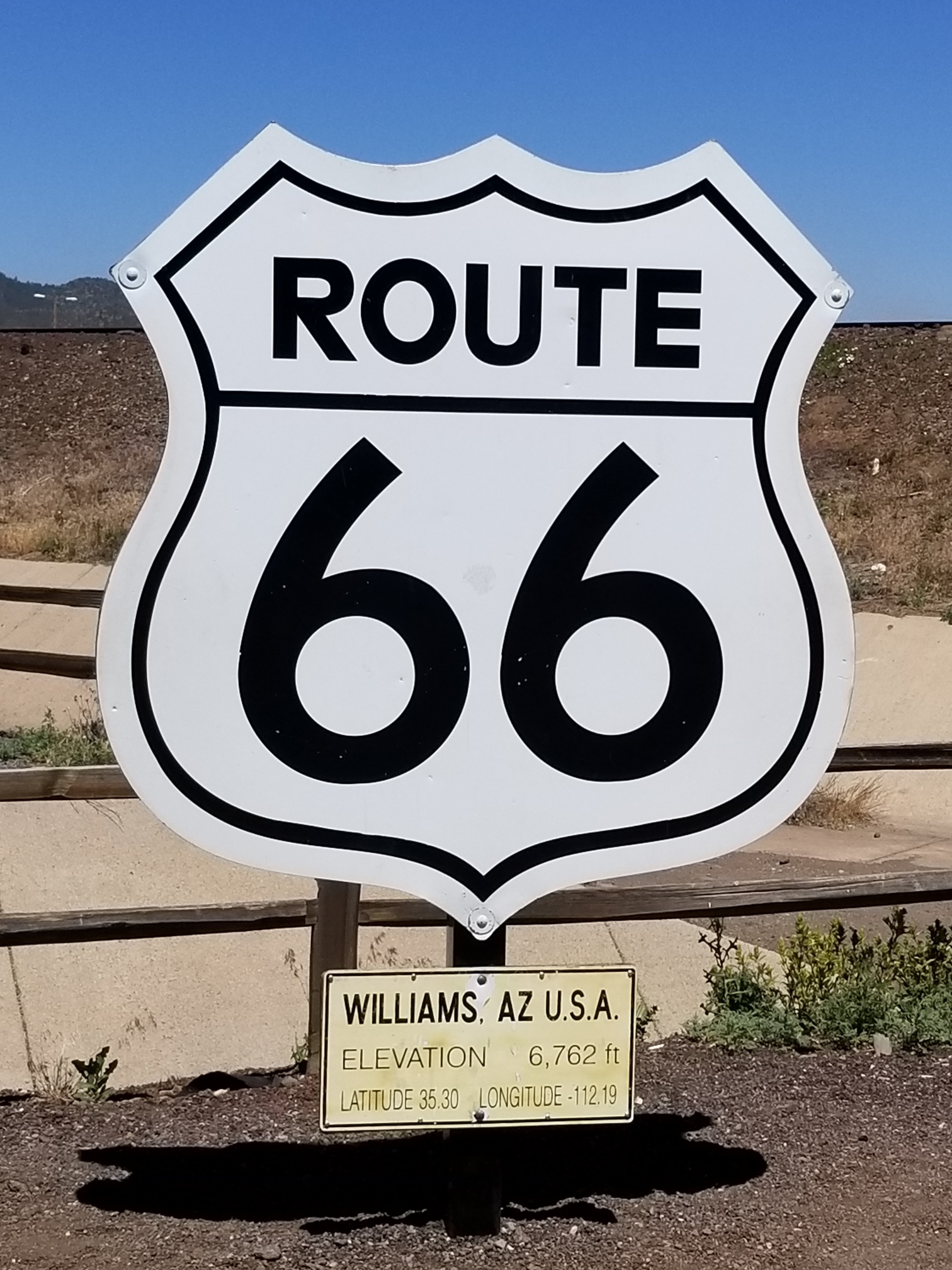
The next day was to be our last in Arizona. We set off west along I-40 in search of the weird and wonderful, with our first stop at Williams, AZ:
Williams is noteworthy by being the last place bypassed by I-40, making Route 66 obsolete, in 1984. It also is the southern terminus for the Grand Canyon Railroad which runs daily to Grand Canyon Village on the south rim. If we'd known about it we would have added it to our list for this trip so it goes on our "next time we're here" list.
Continuing west, we headed off the Interstate onto the aforementioned Route 66 at Seligman, AZ. Unlike a lot of little towns that have died without the traffic the "Mother Road" provided, Seligman has chosen to play it up with lots of kitsch and memories, making it a welcome diversion for travellers like us:
We set out to cover the whole stretch of Route 66 to Kingman, AZ because the Grand Canyon Caverns near Peach Springs offered a unique setting for a diner, situated 200 feet down in a grotto. Unfortunately, the elevator was busted so no joy there. It's a lonely stretch of road that evokes a time when highway driving didn't mean four-lane freeways, massive truck stops and billboards:
After returning to I-40 we decided to wander south to Lake Havasu City. We had hoped to play some golf at Emerald Canyon because it looked like a unique spot but the heat discouraged that notion:
Along the way we encountered this at Yucca, AZ: Onward we went, undaunted. Lake Havasu City is known for one thing -- London Bridge. Yes, that London Bridge, y'know, the one that's falling down, falling down. The story goes that, in the early 1970's, a local developer wanted to attract people to this new retirement community he established on the shores of a reservoir in the middle of the Mojave Desert so he offered to buy the London Bridge. The city of London was in financial straits at the time and the bridge required extensive repair, so they said "yes". The story, as published at the time, claimed the buyer thought he was buying Tower Bridge, thinking it was London Bridge. the story has since been refuted but I like it the way it was.
Anyway, they disassembled the bridge and numbered each block, then shipped it to Arizona where it was painstakingly reassembled on it's new site. It's now surrounded by English kitsch with Union Jacks flying and telephone booths and... you get the picture. Anachronistic? Yes, but truly American 😏.
With that sight checked off we crawled back into the hot car (see above) and headed north to the metropolis of Pahrump, NV, jumping off point for Death Valley. It was a lot of driving for one day but nothing compared to what we took on Friday.
We set our alarms for 3:45 am so that we would get to Zabriskie Point near Furnace Creek, CA, in the heart of Death Valley, in time for sunrise. Furnace Creek is known for two things: the lowest point in the U.S. at around -200 feet and the hottest recorded temperature in the world, 57C in 1911. The forecast called for a cool day with a high of 46C and the previous day's 43C didn't agree with the car so we needed to be out of the furnace before things got too toasty.
We were the first to arrive. People slowly trickled into this viewing area 100 miles from nowhere. It was a bit spooky, like a scene from Close Encounters Of The Third Kind. The vista from our vantage point was both arid and awesome and we spent an hour watching the colours change as the sun rose above the mountains to the east.
As I said, it was hot. The temperature when we left at 6:30 am was 35C so we "hot footed" it out of there. What a desolate place, with nothing for as far as the eye can see.
... and this...
After two hours we climbed the mountains on the western side of the valley and emerged into the eastern side of the Sierra Nevada mountains. What a dichotomy! Furnace-like desert to the east and snow-capped 10,000 foot mountains to the west. It was all a bit surreal. We'd come from one of the driest places on Earth and, an hour later, landed in an area where roads had only recently been flooded out due to melting of this past winter's snowpack. Crazy.
Our original target on this day was Yosemite National Park which, since we'd started our day at 4:00 am, was a reasonable distance to travel so we'd be done by noon. Plan A collapsed along with State Road 120 as there was no way to get to Yosemite without adding six hours drive due to the collapsed road. We changed to Plan B, which was to head to Lake Tahoe, another four hours north.
Along the way we saw the sign for Manzanar which, if you know your World War II history, is one of the camps where America relocated the population of Japanese-Americans after Pearl Harbor was bombed in 1941. 10,000 Issei (American-born people of Japanese extraction) were housed there from 1942 until 1945 because the panicked populace were afraid these Americans' sympathies were with the Emperor.
A sad and disappointing time in America's history. From there we continued north, stopping only for gas...
For those of you in Canada complaining about the high cost of gas, I'll do the math for you. In CAD, that $8.48 per US Gallon. A US Gallon is equal to 3.8 litres so, that works out to $2.23 per litre, all you people complaining about carbon taxes.
Now, I've probably driven well over a million miles in my almost fifty years of driving. I've driven dirt roads at the tops of mountains in Colorado, dodged potholes in South Africa and avoided cane toads in Queensland but yesterday I encountered a road that scared the crap out of me. Picture yourself climbing the side of a mountain on a narrow, two lane road, going up at about a 45 degree angle (really) followed by a hairpin left turn with a two thousand foot drop with no guardrail and only about two feet of gravel between the road and the edge. Google took me on this "shortcut" and there was no place to turn around. After a half hour of this harrowing climb I reached the top, hyperventilating and sweaty, at which point, thankfully, Penny woke up. I say "thankfully" as, if she'd awoken while it was happening she likely would have screamed and who knows how that would have ended! Google's shortcut did save us fifteen minutes though, so it was worth it 😦.
Another hour later we reached our lodgings for the night, a motel beside the American River with our room overlooking it as you saw at the beginning. To top it off, the owner handed us a couple of cold Coronas and sent us to cool our feet in the river. The beer was cold, but not as cold as the river!
It was certainly an eventful drive over those three days. Today, we head to Richmond, CA, for our next house sit. Richmond is across the bay from San Francisco, just north of Berkeley. Stay tuned as our adventures continue.


Wonderful photos, but JASUS .... the price of gas down that way !! S & B Gallagher xox
ReplyDeleteGreat road trip, you're seeing some wonderful places. Fantastic pics. Totally agree with you about the Grand Canyon, my favourite place ever! The colours and vastness. We're paying the equivalent of Can $2.50 per litre for unleaded 4star petrol here in Oxfordshire UK.
ReplyDelete